How New Zealand Engineers Safer Roads
Every year, New Zealand spends hundreds of millions of dollars on road infrastructure, and the question of whether that money is saving lives is not rhetorical — it is answerable, at the level of specific projects on specific corridors. The engineering-led approach to road safety has shifted the sector’s attention from driver behaviour to road design, asking not whether people make mistakes but whether the road forgives them when they do.
The Safe System: Engineering Human Error Out of the Equation
Why the Old Approach Stopped Working
For most of the twentieth century, road safety in New Zealand was primarily a message problem. Speed cameras, drink-drive campaigns, seatbelt enforcement — the working assumption was that if drivers changed their behaviour, the toll would fall. And for a time, it did. The road toll dropped sharply through the 1990s as seatbelt wearing became near-universal and blood alcohol limits tightened. But by the mid-2000s, the annual toll had plateaued around 400 fatalities despite continuing enforcement effort.
The uncomfortable finding, confirmed by international research, was that human error is not a fixable variable. Drivers misjudge speeds, misread junctions, and fall asleep — consistently, predictably, at rates that enforcement cannot move much further. The Safer Journeys strategy, adopted in 2010, represented NZ formally acknowledging that the road environment itself had to carry more of the safety burden. If a driver crosses a centreline, the road should stop that being a fatal event. That shift in responsibility — from the individual to the system — is the foundation of everything that followed.
What Safe System Actually Requires of Infrastructure
The Safe System framework, developed originally in Sweden and the Netherlands as Vision Zero and Sustainable Safety respectively, rests on a single biomechanical fact: the human body can only absorb so much crash force before injury becomes unsurvivable. For a pedestrian, that threshold is around 30 km/h. For an occupant in a side-impact crash, around 50 km/h. For a head-on collision between two vehicles, the combined closing speed determines survivability — and on an undivided 100 km/h highway, the forces involved are almost always fatal.
Safe System infrastructure design works backwards from these limits. A forgiving road separates opposing traffic flows so a lane departure does not create a head-on scenario. It uses clear zones and wire rope barriers on the roadside so run-offs do not end in fixed-object collisions. It manages intersection geometry so conflict points occur at low speed. The framework has four pillars — safe roads, safe speeds, safe vehicles, and safe road use — but in NZ, where the vehicle fleet is ageing and enforcement resources are finite, the infrastructure pillar carries disproportionate weight.
How NZTA Translates the Framework into Funded Programmes
The National Land Transport Programme (NLTP) is NZTA’s three-year investment plan, funded through a combination of fuel excise duty and road user charges collected under the Road User Charges Act. Safe System principles have progressively shaped how that money is allocated. The high-risk rural roads programme has directed capital at the corridors where crash frequency and severity are highest — typically undivided state highways with high traffic volumes and poor geometry.
The Roads of National Significance — the previous government’s highway upgrade programme — produced divided expressways on corridors like the Waikato Expressway and Transmission Gully that are structurally much safer than the routes they replaced. NZTA uses a Benefit-Cost Ratio (BCR) methodology that assigns dollar values to crashes by severity, making infrastructure investment directly comparable and auditable. A Safe System intervention that costs million and prevents one fatal crash per year will typically return a BCR well above 1.0 — making the safety case and the economic case simultaneously.
Median Barriers: The Single Biggest Life-Saver on Rural State Highways
The Head-On Collision Problem on Undivided Two-Lane Highways
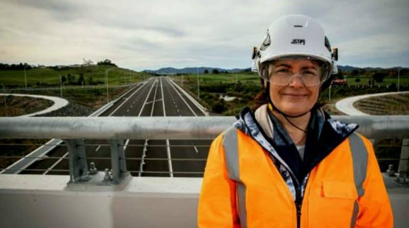
New Zealand’s state highway network is dominated by undivided two-lane roads connecting regional centres across mountainous or hilly terrain. There are limited practical alternatives — the geography that makes four-lane motorways impractical also makes the two-lane highways the only viable route for both freight and passenger traffic. Head-on crashes on these corridors are catastrophically overrepresented in the fatal toll, a pattern consistent with iRAP global road risk data.
When two vehicles travelling at 100 km/h collide head-on, the closing speed is 200 km/h and the deceleration forces involved are far beyond what a human body can survive regardless of vehicle safety rating. The causes are mundane: a moment of microsleep, a wide truck forcing an oncoming driver onto the sealed shoulder, a passing manoeuvre misjudged by a second. None of these events requires driver negligence in the usual sense — they happen to experienced, attentive drivers on familiar roads. That is precisely why engineering intervention is the correct response. Waiting for drivers to stop making momentary errors is waiting for something that will never happen.
Wire Rope Versus Concrete: Choosing the Barrier Type
Wire rope safety barriers (WRSB) are the dominant choice for median treatment on New Zealand’s rural two-lane highways. Three or four tensioned cables mounted on flexible posts, the system works by catching and redirecting vehicles rather than stopping them abruptly — the rope deflects under impact, absorbing energy, and guides the vehicle back into its lane. The installation cost on a rural two-lane median is substantially lower than concrete barrier, and the forgiving posts cause less secondary damage to vehicles that hit them at oblique angles. On narrower roads where a concrete median would unacceptably reduce lane width, WRSB is often the only viable option.
Concrete barriers are reserved for higher-traffic divided highways and urban motorway environments where the operating speeds, traffic volumes, and available median width make them appropriate. The choice involves trade-offs:
– WRSB: lower cost, flexible deflection, better for narrow medians, requires post-impact maintenance
– Concrete barrier: harder stopping surface, minimal maintenance, problematic for motorcycles, requires wider median
NZTA’s engineering standards set out the decision matrix in detail, accounting for traffic volume, design speed, median width, and the expected crash type on a given corridor.
Outcomes from the Median Barrier Rollout
The median barrier programme on New Zealand’s state highways has produced measurable reductions in head-on fatalities on treated corridors. Sections of State Highway 1 through the Waikato that received wire rope median barriers in the mid-2010s showed significant drops in fatal head-on crashes in subsequent monitoring periods, consistent with international evidence that median barriers reduce head-on fatalities by 70 to 90 percent on treated sections.
The Transmission Gully motorway, which opened in 2022, replaced a notoriously dangerous section of the old SH1 through the Kapiti Coast hills with a fully divided, median-separated expressway — a structural upgrade that eliminates the head-on crash type entirely on that corridor. NZTA’s economic appraisal framework values a statistical life at over million, meaning even moderate crash reduction on a busy corridor generates benefit-cost ratios that comfortably justify the capital expenditure. The programme is not complete — significant lengths of undivided rural state highway remain untreated — but the evidence base for continuing investment is well established.
Intersections Reengineered
Roundabout Conversions and the Crash Data Behind Them
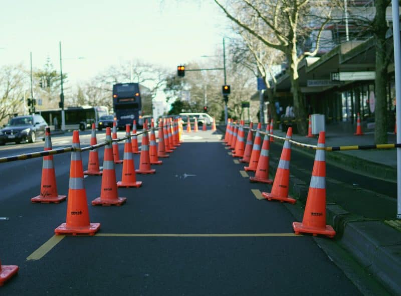
Signalised intersections and priority-controlled junctions share a common flaw: they require drivers to make correct decisions under time pressure, often at high approach speeds. A right-turn misjudgement at a signalised intersection can result in a T-bone collision at combined speeds that exceed survivability thresholds. Roundabouts eliminate the highest-severity crash types by design — there are no head-on or right-angle conflicts at a properly designed roundabout, only low-speed merging and weaving movements.
New Zealand’s crash reduction factors estimate that converting a priority intersection to a roundabout reduces fatal and serious injury crashes by around 60 to 75 percent, a figure consistent with international evidence reviewed in NZTA’s economic appraisal guidelines. That figure has driven substantial conversion activity on both state highways and local roads. The Palmerston North ring road roundabouts, the upgrades on the Nelson-Blenheim SH6 corridor, and numerous urban conversions in Auckland and Christchurch have all been justified on this basis. The data from monitored conversions generally confirms the predicted reductions, giving engineers confidence in the methodology.
Raised Platforms and Junction Visibility
At lower-speed urban intersections, the engineering toolkit extends beyond roundabouts to include raised intersection platforms and geometric modifications that reduce vehicle speed through the conflict zone. A raised table — where the entire intersection is elevated to footpath level — forces drivers to slow as they approach the vertical transition, and the higher platform position improves sight lines between drivers and pedestrians. Kerb build-outs at corners reduce the pedestrian crossing distance and tighten the turning radius for vehicles, which lowers turning speed and gives pedestrians more time to clear.
These interventions are particularly cost-effective because they work on existing road layouts without requiring significant property acquisition or major reconstruction. The challenge is consistency: a driver who encounters a raised table only occasionally may not anticipate it, particularly at night. New Zealand’s engineering practice requires adequate advance warning signage and clear delineation, and the evidence from urban road safety audits suggests that well-implemented raised treatments produce reliable speed reductions of 10 to 15 km/h through the treated zone.
Right-Turn Treatments on High-Speed Rural Roads
The right-turn movement at a rural intersection — a vehicle turning across oncoming traffic to enter a side road — is one of the most dangerous manoeuvres on the New Zealand network. A driver waiting to turn is stationary or slow in a 100 km/h traffic stream, and a vehicle approaching from behind may not realise the hazard in time to stop.
The standard Safe System treatment is a channelisation island that physically separates the right-turn waiting bay from the through-traffic lanes, giving turning drivers a protected waiting area and reducing the exposure time in the traffic stream. On higher-volume junctions, a dedicated auxiliary right-turn lane with its own acceleration and deceleration taper allows the movement to happen outside the through-traffic path. Where traffic signals are warranted, a protected right-turn phase eliminates the conflict entirely. The economics are favourable: a channelisation treatment on a rural T-intersection might cost 00,000 to 00,000 — modest against the cost of a single serious injury crash. NZTA’s high-risk intersection programme has prioritised these works on corridors where the crash history identifies the turning movement as the primary risk, drawing on Austroads research into rural intersection safety.
Speed Management as Infrastructure, Not Enforcement
Variable and Permanent Speed Limit Reductions Tied to Geometry
New Zealand’s speed limit framework historically set limits by land use type rather than road geometry. The 100 km/h rural default applied to a straight, sealed highway and to a winding gravel road through a river gorge with equal indifference to their very different risk profiles. The 2022 Speed Management Guide, developed by NZTA, introduced a risk-based approach that ties the appropriate speed limit to the road’s actual geometry, function, and adjacent land use.
Under this framework, a local road near a school with restricted sight lines might warrant a 40 km/h limit; a rural highway through dairy country with frequent farm vehicle crossings might move from 100 to 80 km/h. The guide gives road controlling authorities — both NZTA and local councils — a structured methodology for setting limits that reflect crash risk rather than administrative convenience. The political reception has been mixed, particularly in rural communities where lower limits are perceived as inconvenience rather than protection. The engineering case, however, is straightforward: each 10 km/h reduction in operating speed on rural highways corresponds to a substantial reduction in crash severity.
Road Geometry as a Speed Signal
Posted speed limits only work if the road environment supports them. A driver on a straight, wide, well-surfaced highway will naturally travel at a speed that feels comfortable — and that speed may be considerably higher than the posted limit if the physical environment does not signal constraint. The self-explaining road concept, influential in European road design and increasingly referenced in New Zealand practice, holds that the road should communicate its safe operating speed through its physical form.
Lane width is the most powerful cue: narrow lanes prompt drivers to slow because the margin for error feels smaller. Centreline rumble strips and audio-tactile edge lines reinforce the sense of a constrained operating environment. Gentle curvature encourages deceleration by creating genuine uncertainty about what lies ahead. Conversely, a wide, straight, smooth-surfaced road with generous clear zones communicates that high speed is safe — even when it is not. New Zealand engineers working on rural highway upgrades now explicitly consider whether geometric improvements that increase pavement standard might inadvertently encourage higher operating speeds, and whether those speeds are consistent with the crash tolerance the infrastructure can provide.
Tracking Casualties Against Investment
Measuring whether infrastructure investment is actually reducing casualties requires robust data, consistent methodology, and enough patience to distinguish trend from noise. New Zealand’s primary metric shifted during the 2010s from raw road toll to KSI — killed or seriously injured — which captures serious harm more completely than fatality counts alone and is less volatile year to year. The Safer Journeys strategy set a target of making New Zealand’s roads among the safest in the world by 2020; that target was not achieved, though the KSI rate per billion vehicle kilometres travelled did improve.
The successor Road to Zero strategy, covering 2020 to 2030, targets a 40 percent reduction in deaths and serious injuries against the 2018 baseline. Progress is tracked through the NZTA’s annual Road Deaths report and the Crash Analysis System (CAS), which records the location, type, and severity of every reported crash. Infrastructure spend is tracked against casualty outcomes at the corridor level, allowing before-and-after evaluations of specific projects. The honest assessment of the data is that infrastructure investment works — treated corridors show sustained reductions — but the untreated network remains large enough that aggregate national progress is slower than the Safe System ambition demands.
New Zealand’s road toll is not a mystery to be solved by better policing or sharper marketing. It is an engineering problem — one that yields to median barriers, roundabout conversions, geometric redesign, and speed environments that match human biomechanical limits. The infrastructure investment record shows that these interventions work. The remaining challenge is scale and pace.
5 Comments
The point about wire rope versus concrete barriers is something I wish more people in local government understood before they start asking why we can’t just put up the cheaper option everywhere. Wire rope works because it deflects and absorbs — stick a concrete barrier on a rural two-laner with limited deflection room and you have traded a head-on risk for a barrier strike risk. The section on barrier type selection here is the clearest lay summary I have seen.
Agree with Glen on the barrier type explanation. I would add that the post-impact maintenance picture for wire rope gets glossed over in these discussions too. A struck section of WRSB needs to come out of service for repair — sometimes for days on narrow corridors. The article focuses on the fatality reduction, which is the right headline, but the operational cost of a high-strike corridor needs to factor into the cost-benefit as well.
The shift from raw road toll to KSI as the headline metric was long overdue. Counting fatalities alone meant you could get a good-looking number in a year when injuries were up — the toll was down because ICU care had improved, not because the roads were safer. KSI captures the actual crash harm better. What I would like to see next is a breakdown of which intervention types are driving the KSI reductions — the article says median barriers are the single biggest life-saver but doesn’t quantify the relative contribution of roundabout conversions.
The section on self-explaining roads and road geometry as a speed signal is relevant to a lot of the disputes we see at the local level about posted speed limit changes. Residents often focus entirely on the number on the sign and resist reductions, but the actual lever is whether the physical environment — lane width, seal width, curve radius — is consistent with the target speed. A narrow road with tight bends will regulate itself; a wide, straight sealed road won’t, regardless of what the sign says.
Good piece overall. One thing I’d push back on slightly: the article frames the remaining challenge as purely scale and pace — more of the same interventions, faster. That’s probably right for median barriers on state highways. But on the local road network, particularly unsealed rural roads, the Safe System toolkit doesn’t translate as cleanly. The geometry redesign options that work on sealed state highways have very different cost profiles on a gravel road maintained by a small council with a tight NLTF subsidy. That gap in the framework deserves more attention.