When the Weather Wins: Climate and New Zealand’s Roads
New Zealand’s road network operates in conditions that would give a European highway engineer pause. Steep terrain, intense rainfall, active fault lines, and a coastline that offers no shelter from the Tasman Sea and the Pacific simultaneously – the physical setting demands more from roading infrastructure than the funding available to maintain it. Climate change is not creating a new problem so much as accelerating an existing one, pushing weather events outside the design envelopes of infrastructure built on assumptions that no longer hold.
The Geography of Exposure
A Country Built on Fault Lines and Weather Fronts
New Zealand asks more of its roads than most countries bother to imagine. Pack a country the size of the United Kingdom with fewer than five million people, then run it through a spine of fault-crossed mountains, give it a climate that ranges from subtropical in Northland to genuinely sub-alpine across the Mackenzie Basin, and wrap the whole thing in 15,000 kilometres of coastline. Then ask a road network to hold it all together.
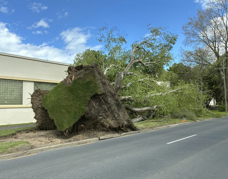
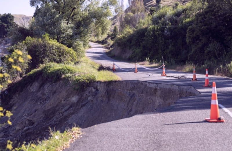
The terrain itself is the first problem: steep catchments mean that rain falling on high ground reaches watercourses fast, producing flash flooding that can overwhelm culverts within hours of a storm arriving. The second problem is geological instability. Large parts of the South Island and the East Coast of the North Island sit on lithologies – greywacke, papa mudstone, soft sedimentary rock – that behave badly when saturated. Cut slopes that look stable in summer become slip-prone the moment a wet winter saturates the material behind them.
The third problem is the sheer length of the network relative to the population that funds its maintenance. NZTA manages roughly 11,000 kilometres of state highway, and local authorities manage another 83,000 kilometres of local road. The per-kilometre funding available is modest by international standards. Running a network at that scale through that terrain, in that climate, is a condition that demands engineering humility – and usually does not get it.
Coastal Roads and the Rising Tide Problem
The most exposed sections of New Zealand highway are not in the mountains – they are at sea level, clinging to cliffs above open water. The Kaikoura coast section of SH1 is the most famous example: a strip of road pinched between the Kaikoura Ranges and the Pacific, with almost no room to move when either the rock above or the sea below becomes hostile. The 2016 Kaikoura earthquake demonstrated what the geology above could do in eleven seconds. Storm surge and coastal erosion demonstrate what the sea does over decades.
Along the Kapiti Coast, sections of SH1 run within metres of an eroding shoreline that retreats measurably after heavy westerly swells. On the West Coast of the South Island, SH6 and SH67 traverse river mouths and coastal flats where storm surge can deposit sand across the carriageway or undercut the road shoulder. These are not rare events. The Westland District Council, managing roads on a thin budget for a thin population spread over a large exposed area, has documented consistent annual damage to coastal road assets that repair budgets can barely keep pace with.
The trajectory is not improving. Projections from the New Zealand Climate Change Commission indicate sea level rise of between 0.3 and 1.0 metres over the remainder of this century – a range that, even at its lower bound, changes the return period for coastal inundation events on roads that were never designed with that baseline in mind.
Alpine Roads: Where Gradient Meets Precipitation
State Highway 94, the road to Milford Sound, is arguably the most dramatic stretch of managed highway in the country – and the most logistically precarious. The route climbs through the Homer Tunnel and descends into Fiordland through terrain that receives up to eight metres of annual rainfall in some catchments. There is no alternative route to Milford Sound by road. When SH94 closes, the connection closes entirely.
The Homer Tunnel sits beneath avalanche paths that activate reliably every winter and after heavy snowfalls at altitude. NZTA manages this with controlled explosives – blasting identified paths to release snow on schedule rather than at random – along with a network of monitoring sensors and strict closure protocols that can shut the road within minutes of a triggering event. The system works, but it is intensive. The manual effort required to keep a single 120-kilometre stretch accessible for nine or ten months of the year represents a disproportionate share of regional maintenance resources.
The Otira Gorge section of SH73, the main crossing of the Southern Alps via Arthur’s Pass, presents similar but distinct challenges: the gorge is narrow, water volumes during heavy rain are enormous, and a single large slip can close the route for days. Both corridors are managed not because the engineering cost is justified by traffic volumes – it frequently is not – but because the communities and tourism infrastructure at the end of the road have no other option.
When Events Overwhelm the Network
Cyclone Gabrielle and the Scale of Sudden Loss
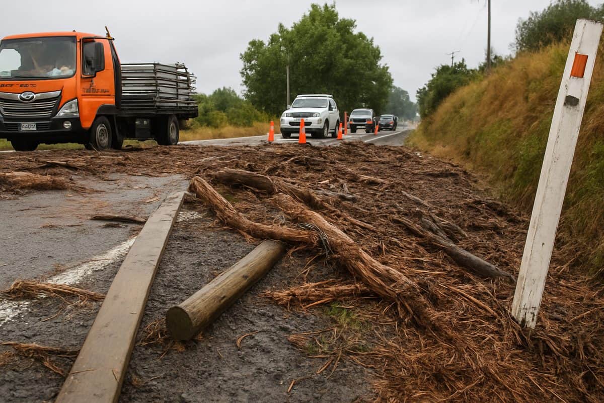
Cyclone Gabrielle made landfall on the North Island in February 2023 and produced damage to roading infrastructure at a scale that stretched the language of asset management to its limits. The Hawke’s Bay, Tairawhiti, and Northland regions bore the worst of it. In Hawke’s Bay alone, NZTA estimated damage to the state highway network at over $400 million in the immediate aftermath – a figure that climbed as engineers reached previously inaccessible sites.
The Napier-Wairoa section of SH2 was closed for months, cutting the primary land connection between Napier and the Mahia Peninsula and forcing freight, emergency services, and residents onto a circuitous inland detour that added hours to every trip. Several bridges were destroyed or made structurally unsafe by debris loading. Dozens of slips blocked sealed roads across the wider region, many of them on routes that local councils rather than NZTA were responsible for – and local councils had nothing close to the financial reserves to respond at speed. The repair bill across the full road network, state and local, ran into billions when assessed across 2023 and into 2024.
What Gabrielle exposed was not a failure of maintenance but a failure of design assumption: roads built to survive expected weather events were overwhelmed by an event outside the design envelope. The question that followed – how to decide which roads to rebuild to existing standard and which to rebuild to a higher one – has not been cleanly answered.
Milford Road: Managing Avalanche Risk at Scale
The management of avalanche risk on the Milford Road is one of the more quietly impressive ongoing engineering programmes in New Zealand, and one that rarely receives the attention it deserves outside of road safety and civil engineering circles. NZTA’s Milford Road Alliance – a collaborative arrangement between NZTA, local contractors, and specialist providers – runs avalanche control operations through winter and spring using a combination of remote monitoring, targeted explosive charges placed by helicopter, and snow study stations that track snowpack depth and density at key locations above the road.
The principle is straightforward: a controlled avalanche on a known path, triggered at a time when the road can be closed briefly and safely, is far preferable to an uncontrolled release when a tourist coach is in the Homer Tunnel approach. The execution requires experienced practitioners who understand both the terrain and the meteorology. Warm rain on a heavy snowpack is the highest-risk condition. Freeze-thaw cycles through spring loosen the bond between snow layers and the underlying slope. Monitoring data helps, but final judgements about whether to blast a path or hold it for another 24 hours remain human decisions made under time pressure and imperfect information.
The Alliance has a strong safety record. What it illustrates, though, is that keeping certain sections of the network open requires continuous active management at a level that most roads do not demand – and that level of management is only possible because the economic case for Milford Sound as a tourism destination generates the political will to fund it.
Canterbury Freeze-Thaw: The Quiet Road Killer
Canterbury and the Mackenzie Basin experience a temperature cycle that most of New Zealand’s road network does not: hard frosts in winter followed by warming through the day, then freezing again at night. This freeze-thaw cycling is mechanically destructive to sealed road surfaces in ways that rainfall alone is not. Water infiltrates cracks in the pavement – cracks that exist in every sealed road surface after a few years of use – and expands by roughly nine percent as it freezes. That expansion forces the crack wider. The next day’s thaw contracts it again but leaves the crack slightly larger than before.
Over a Canterbury winter with repeated overnight frosts, a road surface can deteriorate by the equivalent of several years of normal wear in a matter of months. The technical terms are frost heave when the process works from below, pushing subgrade material upward into the pavement structure, and pavement fatigue cracking for the surface manifestation. The practical result is potholing and structural pavement failure that appears suddenly, especially after the first hard frosts of winter, and spreads faster than reactive maintenance crews can address it.
Waka Kotahi maintenance contracts in these regions carry higher per-kilometre costs than comparable rural roads in Waikato or Manawatu because the treatment cycles have to be more frequent. The complication is that Canterbury winters have become less predictable – some years delivering the frost cycles that drive pavement damage, others delivering wet conditions that cause slipping and washout instead. Maintenance programmes designed around seasonal norms increasingly encounter conditions that fall outside the expected pattern.
The Maintenance Budget vs. Adaptation Problem
Reactive Repairs vs. Resilience Investment
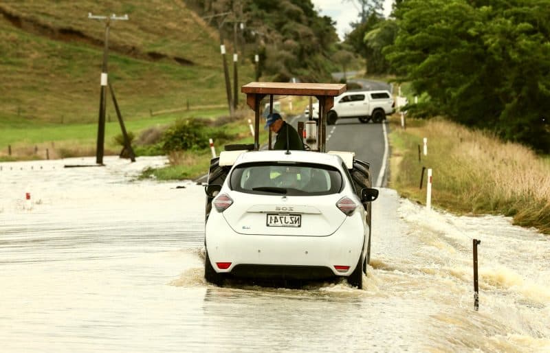
The funding architecture for New Zealand’s road network was not designed with climate escalation in mind. The National Land Transport Programme allocates funding in three-year cycles across activity classes – new infrastructure, renewals, maintenance, emergency works – and the allocations are set against historical averages for what each class costs. When a large weather event occurs, the emergency works allocation absorbs the immediate response costs, but the follow-on structural repairs often exceed what that allocation can carry, triggering supplementary Crown funding and reprioritisation of projects across the rest of the programme.
The practical effect is that resilience investment – spending to harden infrastructure against future events before those events occur – competes directly with reactive spending needed right now. The Infrastructure Commission has identified this tension as a systemic challenge for the NZ transport sector. A retaining wall that prevents a slip from closing SH1 for three weeks in 2028 has to be weighed against a slip that is blocking a road today. Annual budget cycles and the political visibility of immediate road closures tend to favour the reactive spend.
This is not irrational behaviour on the part of road managers. Resilience investment is hard to justify under normal cost-benefit frameworks because the benefit is an event that does not happen – and is therefore invisible. The sector has recognised this problem at the analytical level for over a decade. Progress on addressing it within funding structures has been slower.
How Climate Change Moves the Goalposts for Asset Life
Road infrastructure in New Zealand was largely designed using rainfall intensity data compiled in the twentieth century – the Rational Method drainage calculations underpinning most culvert and bridge sizing relied on return-period rainfall depths that, at the time, represented reasonable estimates of what the design life of the asset might encounter. Those design envelopes are shifting.
The Intergovernmental Panel on Climate Change has projected with high confidence that extreme rainfall events will become more intense under warming scenarios, and research by NIWA specific to New Zealand projects increases in heavy rainfall frequency across most of the country – particularly in the west of both islands – over the coming decades. A culvert sized to handle the 1-in-50-year storm under 1990s assumptions may be handling the 1-in-20-year storm by 2040.
The implication for asset management is significant. Long-lived infrastructure – a concrete bridge, a major retaining wall, a tunnel portal – carries design assumptions baked in at construction that may be wrong within the asset’s intended service life. Retrofitting drainage capacity into existing structures is expensive and often technically constrained: you cannot always widen a culvert that sits under three metres of embankment without effectively rebuilding the embankment. The shift in climate baselines is not a distant problem for the next generation of road planners. It is a current problem for the assets being maintained and renewed right now.
Insurance, Crown Funding, and Who Pays for the Gap
When a major weather event destroys road infrastructure in New Zealand, the financial response is largely a Crown matter. The Earthquake Commission does not cover roading assets – EQC cover applies to residential land and certain structures, not public infrastructure. NZTA holds no conventional insurance over its network. Instead, large-scale damage triggers Crown emergency funding, typically through Treasury supplementary estimates or the National Disaster Relief and Recovery Arrangement. The mechanism works, but it is slow: emergency funding decisions involve Cabinet, and in the immediate aftermath of a major event, when contractors need mobilising and communities need connection, the funding approval process can lag weeks behind operational need.
Local councils managing their own road networks face a sharper problem. Most councils self-insure for roading assets, meaning they carry the exposure directly on their balance sheets. A small district council hit by a significant weather event – the Tairawhiti experience in 2023 illustrates this – can find its road repair liabilities in a single storm exceeding its total annual roads budget several times over. Central government assistance through the Local Government Funding Agency and direct Crown grants fills some of that gap, but not quickly and not in full.
The question of whether New Zealand should develop a more structured pre-event financing mechanism for road network resilience – a dedicated reserve, a parametric insurance product – has been raised in policy discussions but has not produced a funding solution.
Engineering Responses and the Long Game
Climate-Adaptive Design: What It Actually Means on the Ground
Climate-adaptive design for roads is a phrase that covers a wide range of interventions, from the straightforward to the genuinely novel. At the straightforward end: upsizing culverts during routine renewal cycles, raising road profiles above updated flood levels, installing rock fall catch-fences on identified unstable slopes. These are proven technologies. The constraint is not engineering knowledge – it is funding consent to pay the adaptation premium over standard renewal cost that a climate-hardened specification carries. A culvert renewal budgeted at $80,000 to like-for-like standard might cost $130,000 if upsized to handle projected peak flows.
At the more complex end of the spectrum, bio-engineering approaches – using deep-rooted vegetation to stabilise slip-prone embankments, revegetating catchments above road corridors to slow runoff rates – have gained traction on research projects but have been adopted patchily in operational programmes. Waka Kotahi has piloted slope stabilisation using native species on several East Coast SH2 sections, with encouraging early results on erosion rates.
Scaling that from pilot to programme requires procurement frameworks and maintenance contracts that recognise vegetation as infrastructure – a cultural shift in how road asset management classifies and funds what it owns.
The Network Redundancy Question
Network redundancy – having an alternative route when a primary road closes – is one of those resilience concepts that sounds obviously correct until you look at a map of New Zealand and price what it would cost. The arithmetic is brutal. Building a parallel crossing of the Southern Alps to provide redundancy for SH73 through Arthur’s Pass would cost billions, serve a fraction of the traffic volume needed to justify the investment under any conventional transport assessment, and take decades to deliver.
The same logic applies to coastal corridors, river crossings in remote regions, and the single-access-point communities that are scattered throughout Fiordland, the West Coast, and the East Cape. New Zealand is, in many respects, structurally over-exposed in ways that cannot be fixed with roads alone. The more realistic policy response has been to improve resilience within single corridors – better drainage, rockfall protection, slip monitoring – combined with network management capability to respond faster when closures occur — responsibilities that fall to NZTA under the Land Transport Management Act 2003.
Ferry access as a temporary alternative to coastal road closures has been used in the Kaikoura context. Airstrip access maintains connections to some isolated communities when roads fail. These are practical substitutes, not systemic solutions. The honest policy position is that some sections of the New Zealand network will remain highly vulnerable to weather closure, the cost of eliminating that vulnerability exceeds any rational investment threshold, and the management task is to reduce frequency, reduce duration, and ensure response when closure is unavoidable.
Monitoring, Data, and the Early Warning Advantage
The tools available for managing a weather-exposed road network have improved considerably over the past decade. Road Weather Information Systems (RWIS) deploy sensor arrays at key locations on the network measuring road surface temperature, wind speed, visibility, and precipitation. NZTA operates several hundred of these stations across the state highway network, feeding data into control rooms that can trigger variable message signs, speed restrictions, and closure warnings in real time.
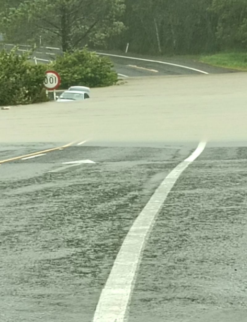
During Cyclone Gabrielle, real-time sensor data from the Hawke’s Bay network informed decisions about which roads to close before flood levels reached critical points – potentially preventing vehicles from becoming stranded on roads that subsequently went under water. LiDAR surveys – aerial scanning that produces high-resolution three-dimensional models of terrain and road surfaces – have become a standard tool for condition assessment on slip-prone corridors. By comparing surveys taken months or years apart, engineers can detect millimetre-scale ground movement on slopes above roads before that movement becomes a slip.
The technology is not cheap, but its cost is falling. The analytical challenge is managing the volume of data produced across a large network and translating it into prioritised maintenance and intervention decisions – a problem that machine learning applications are beginning to address, though operational deployment in NZ roading has been modest to date.
The gap between what climate resilience demands and what roading budgets can deliver is not going to close quickly. New Zealand’s geography was always going to make this a difficult problem; the changing climate makes it a more urgent one. What the evidence from Cyclone Gabrielle, from the Milford Road programme, and from the freeze-thaw cycles of the Mackenzie Basin collectively shows is that the network is being maintained, heroically in places, but that maintenance is not the same as adaptation. The long game requires different funding logic, longer planning horizons, and a willingness to accept that some roads will close – and to design the system response around that reality rather than around the fiction that it can always be prevented.
3 Comments
The section on Gabrielle hit close to home – we were in Wairoa when SH2 closed and the detour added nearly three hours to what is normally a straightforward drive. What you’ve written about the design assumption failure is exactly right. The road wasn’t poorly maintained, it just wasn’t built for what hit it. The question of what standard to rebuild to is one the community has been asking since 2023 and still hasn’t had a real answer to.
Good piece. One thing worth adding to the funding section – the three-year NLTP cycle isn’t just a political issue, it’s a procurement issue. Contractors can’t resource up for resilience work they’re not sure will be funded in the next cycle. So even when there’s intent to do climate-adaptive work, the contracting market can’t respond at the scale needed. It’s a systems problem, not just a budget one.
The freeze-thaw section was new to me – I hadn’t thought about how different the maintenance challenge is in Canterbury vs somewhere like Auckland. Does Waka Kotahi publish regional breakdown data on per-kilometre maintenance costs? Would be interesting to see the actual numbers behind that point.